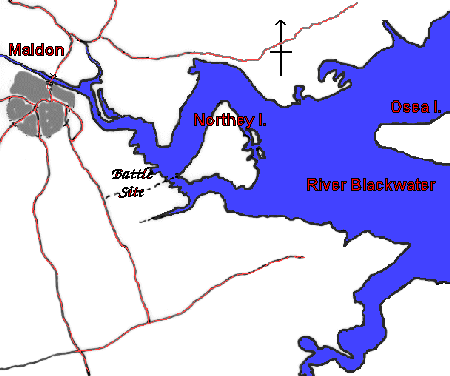
Map of Battle Site
We recommend you look at 'Northey Island' on Google Earth:

In the poem, the River Blackwater is referred to by its old name, the Panta.
The Vikings landed on Northey Island, and were allowed to cross the causeway to fight the battle on the marshy ground and surrounding fields of the mainland. This can easily be seen in the photographs available in 'Site Images'.
A new theory about the true location of the battle site can be found here.
A detailed version of the map is Ordnance Survey Landranger 1:50,000 sheet 168 (Colchester) or Explorer Series 1:25,000 No. 176 (The Blackwater Estuary)